
A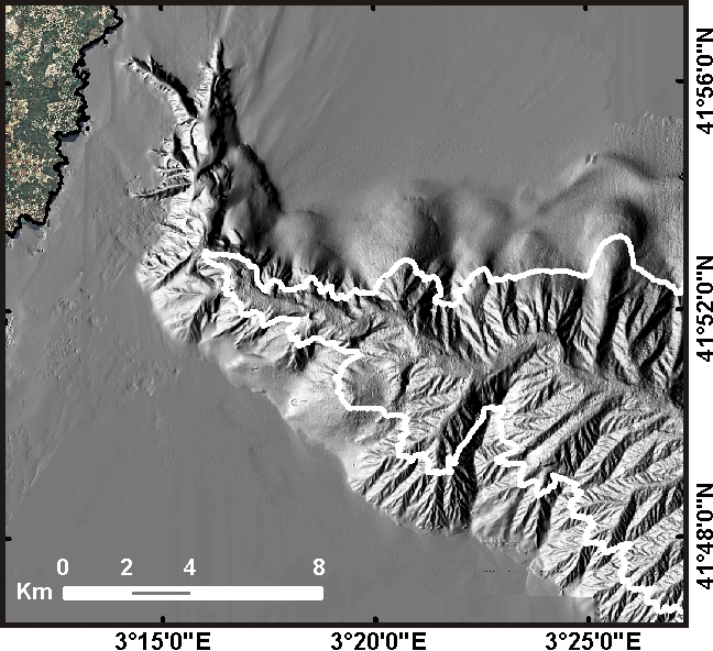 B
B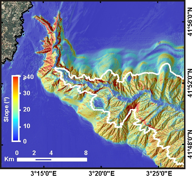
C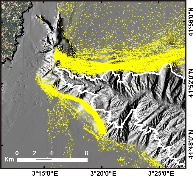
Maps showing how the deep Mediterranean Sea is reshaped at large scale by bottom trawling. Maps produced by CRG Marine Geosciences from UB. They correspond to GES indicator 6 (Seafloor integrity) .
Caption is: Seafloor morphology and bottom trawling in La Fonera Canyon. A, Shaded relief image from a 15-m resolution bathymetric grid showing gullied and smoothed seafloor regions, the latter at depths shallower than 800 m (white contour) especially on the northern canyon flank but also in parts of the southern flank. B,Slope map illustrating regions of homogeneous values between 10º and 30º in the most heavily trawled regions of the canyon flanks compared to untrawled regions where the gullied sea floor and the tributary valley networks are apparent, displaying higher (>40º) and lower (<10º) slopes in the walls and axes of the various valleys, respectively. C, Positioning data (small yellow arrows) of bottom trawling vessels while fishing during a 4-year period.
